

Mobile MagnetoTellurics (MobileMT)
The most advanced generation of airborne AFMAG technology, MobileMT is the only system proven to deliver geoelectrical information from near-surface to greater than 1 km depth with high spatial resolution.
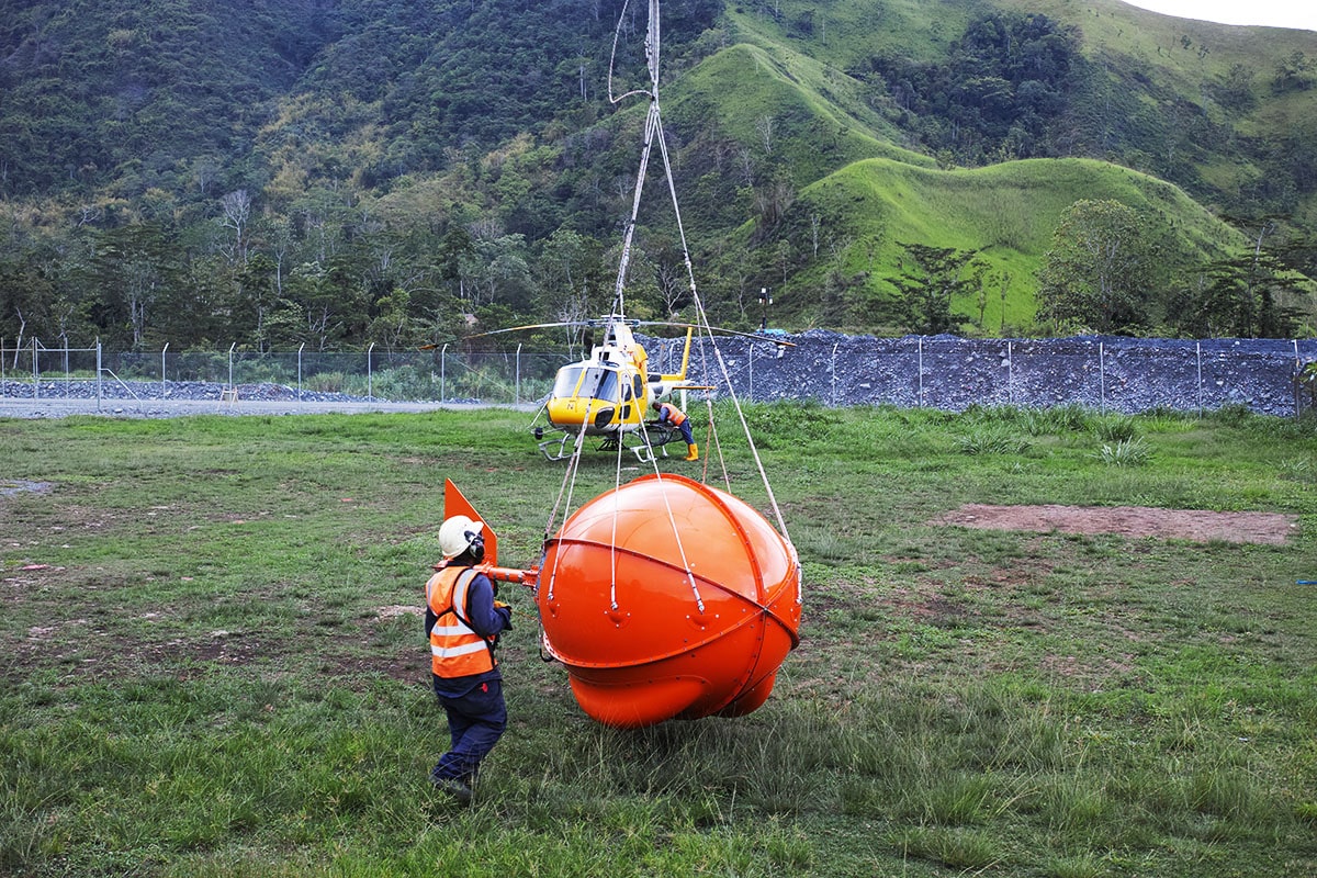
What is Mobile MT?
MobileMT
From Natural-Field Signals to Subsurface Resistivity Models
MobileMT is an airborne natural-field electromagnetic technology that maps subsurface resistivity by measuring variations in naturally occurring EM signals over a broad frequency range. In practice, the airborne system records three-component magnetic fields along flight lines while a ground remote-reference station records horizontal electric fields. MT-style cross-spectral processing and transfer-function estimation are used to derive robust, rotationally invariant responses from the natural-field data. The heliborne system is designed for broadband acquisition (26 Hz to 21 kHz), providing sensitivity to both shallow and deep structures (typically exceeding 1 km, depending on overall subsurface conductance) and improving stability in variable noise environments. The resulting products are geology-meaningful resistivity images that support 3D resistivity mapping, structural interpretation, and targeting.
MobileMT also represents the evolution of airborne AFMAG toward a full multi-component airborne MT implementation, building on early AFMAG prototypes and lessons from earlier commercial and transitional systems. The outcome is a practical exploration tool that converts natural-field EM measurements into coherent subsurface images used by geologists to identify structures, alteration footprints, and key resistivity contrasts, and to focus follow-up work and drilling.
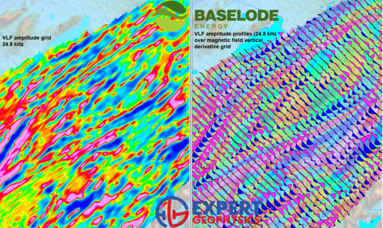
MobileMT is not only broadband EM natural fields, but also EM-VLF signals and a high-quality magnetic field that is not distorted by any nearby transmitting fields.
The VLF signals are received by the same 3 orthogonal MobileMT coils and recorded independently from up to four VLF stations. VLF data is a good complement to the wide range of the MobileMT system depth of investigation and provides additional shallow, high-resolution information. The example below is from the Shadow uranium exploration project, Baselode Energy.